DAY 33
Saturday June
25th 2016
St. Austell
to Thurlestone Miles 135
Today I had the pleasure of being joined by Marilyn for the
final two days of my round Britain trip.
We said our goodbyes to our very generous hosts, Pete & Sue
and returned to St. Austell to start our day, beginning at Porthpean and
Charlestown, where we had ended the drive yesterday.
 |
| Charlestown |
Charlestown is a small harbour to the south of St. Austell. It was originally in private hands and from
the early 1800s through to 2000 was a dock for the export of china clay. However, through various changes in use and
bankruptcies it passed into the hands of a company called Square Sail Ventures that
now use it as a base for their “tall ships” and hire it out for films and TV
programs, such as Poldark. Their main ship is the “Phoenix”. The town also has a museum - the Shipwreck,
Rescue and Heritage Centre.
 |
| Carlyon Bay |
We attempted to go down to Carlyon Bay, but there was a swimming
event going on and parking was very restricted, so we turned around in the car
park and moved on. The swim apparently was for various age groups and involved
a mass start from the beach for a 2km sea swim. There are three beaches in
Carlyon Bay and the area outside of the bay has nice homes. The heyday of Carlyon Bay with its large
concert venue has now passed and there are plans in place to build a large
number of luxury homes here. Unfortunately
planning restrictions and appeals from both developers and locals, has meant
that everything has been stalled since 2011.
Charlestown and Carlyon Bay are really the costal areas of St
Austell so we did not go further into the town but instead headed for Fowey
(pronounced Foy). To get to Fowey you
pass through the dockland area of Par.
Originally this was shipment point for copper but from the mid
nineteenth century until 2007, china clay was the main product shipped from
here. There are plans to redevelop this
area into a marina with luxury residential properties. Near to Par (but not coastal) is the Eden
Project, which opened in 2000 to mark the Millenium. This is built within an old china clay pit
and looks like a large wasps nest with its hexagonal geodetic biodomes, the
insides of which contain plants from all around the world.
 |
| Fowey |
Fowey is built around the mouth of the River Fowey and again has
a history as a port for metal ores and china clay, though in competition with
nearby Par and it was only with the coming of the railway to Fowey that their
fortunes increased. In 1943 Fowey was
the main loading point for ammunition for the US troops that landed on Omaha
Beach on D Day.
 |
| Fowey Architecture |
The town has very narrow
streets with virtually no parking and visitors are encouraged to use the large
car park above the town and walk down.
There are some fine old buildings here and the Parish Church is
dedicated to St. Fimbarrus, who may be synonymous with St. Barry and was another
one of the early Irish priests who brought Celtic Christianity to Cornwall.
We drove through the narrow streets and headed for the ferry,
which crosses the River Fowey and delivers vehicles to Boddinick a tiny village
on the opposite bank. The boatman hardly
has time to take the fee of £1.50 before
you arrive at the other side.
 |
| Polruan Looking Across to Fowey |
Polruan is immediately opposite Fowey and has a blocktower,
paired with one in Fowey that was used to guard the harbour from attack by
sea. A chain was attached to the two
towers and could be raised to block enemy vessels. Daphne Du Maurier the writer once lived in
the town. The entrance down into the
village is a very steep road. A passenger
ferry runs between the village and Fowey.
 |
| Crumplehorn pub close to Polperro |
Journeying on you come to Crumplehorn, with a large pub and a
water wheel still turning on its wall.
The village is the entrance to Polperro, a popular tourist
destination. We managed to drive a
little way into the town before finding it restricted and we had to turn back
and go up out of the town to a large car park.
It costs £4 to park
here and then you can walk a half mile into the town or take a shuttle bus at £2 return
fare. The last time we came here we had
an elderly person on board, but there was no allowance to take elderly or
disabled people closer into the town, it is the car park and shuttle bus or
nothing. We decided to have our lunch (2
large pasta salads, purchased earlier at Tesco in St Austell for £2) and then
take the shuttle bus into Polperro, as neither of us had ever been there. After eating our lunch we had both changed
our mind and did not feel that it was worth the £8 for two people to visit, take a couple of photos
(showcase their town!) and then leave.
So we left!
From other people’s photos it is certainly a quaint old fishing
village, but honestly it did not look unique enough to want to spend £8 to visit
it. This reminded me of Clovelly on the
north Devon coast that charge £7 per person
for you to enter their village. There
are too many other lovely and quaint places that you don’t have to pay to visit
so why pay to go to Polperro? Maybe I
will visit it from the ocean someday and see if I have really missed something
special, but I don’t think so. I can
quite understand that the roads are too narrow for cars, but paying money to
visit so that I can then spend more money in the town, forget it.
 |
| Talland Bay with ridges of red sandstone |
Heading to Looe we came across Porthallow and Talland. Again narrow lanes but we came across a cute
little café almost on the beach at Talland Bay where we had afternoon tea. This is right on the South West Coastal Path
and no doubt is a popular place for walkers.
 |
| South West Coastal Path |
By the time we got to Looe the tide was out and the boats were
high and dry. (This is despite the name
Looe being derived from a Cornish word meaning deep water inlet!). It seems to have been a feature of my trip
that the tide is often out, especially noticeable where the harbour is built
around an estuary.
 |
| Looe |
Looe is divided by the river into East and West Looe. The town being mainly on the west side of the
river. I have been to Looe a number of
times and feel that I know it fairly well.
Last time we were here we had an excellent lunch cooked by a young and
up and coming chef. Looe is now mainly a
small fishing town, but over the years its fortunes have risen and fallen in
accordance with the demand for minerals such as tin and arsenic. In the 1960s and 70s Looe was one of the many
Cornish seaside towns to which artists flocked “because of the light.”
 |
| Seaton |
Following eastwards along the coast the next seaside place is
Seaton. This seems so very different
from any of the other Cornish seaside towns.
Like its namesake in East Devon it is quite open and feels a little bit
bleak. It is certainly not a “cosy”
place. The beach here also seems “sad”,
being a grey coloured shale. This was
the start of the “open windswept geography” that now went all the way towards
Rame Head where The Sound leading into Plymouth begins. We passed through Crafthole and Portwrinkle
(with its golf course on the ocean edge) and then saw a military “fortress”
just above the Tregantle military firing range.
Most of the open country here was marked with red and white poles to
warn that this was a military area where live firing might take place.
 |
| Tregantle Fort |
At Freathy we saw a large holiday home/lodge camp on the cliffs,
which made me realise that this was almost the only one I had seen for a number
of days. It is no doubt popular with the
citizens of Plymouth. The area seemed
moor like and was windswept. We followed
the cliff road around Rame Head and Mount Edgecumbe and eventually found our
way back to the Tregantle fortress and the road into Torpoint and the ferry
across to Plymouth.
 |
| Looking towards Plymouth |
This ferry was the cheapest we had taken all day at £1.40. The ticket seller said that this was because
the company also owned the Tamar Bridge that provides an alternative to the
Ferry. Once in Plymouth we headed for
Plymouth Hoe, where, famously, in 1588 Sir Francis Drake having been notified
of the Spanish Armada approaching is said to have decided to finish his games
of bowls before going to sea to meet them.
Unfortunately the Hoe is not accessible to cars so we stopped below it
in a pub car park that was packed with people enjoying the views across to
Drakes Island.
 |
| Old Eddystone Lighthouse |
On the Hoe is Smeaton’s
Tower, which is the upper portion of the old Eddystone Lighthouse, built by John
Smeaton in 1759, and replaced in 1877.
It was transported brick by brick and reassembled on the Hoe. Plymouth remains as one of the Royal Navy’s
major home ports and the town’s economy is dominated by this.
 |
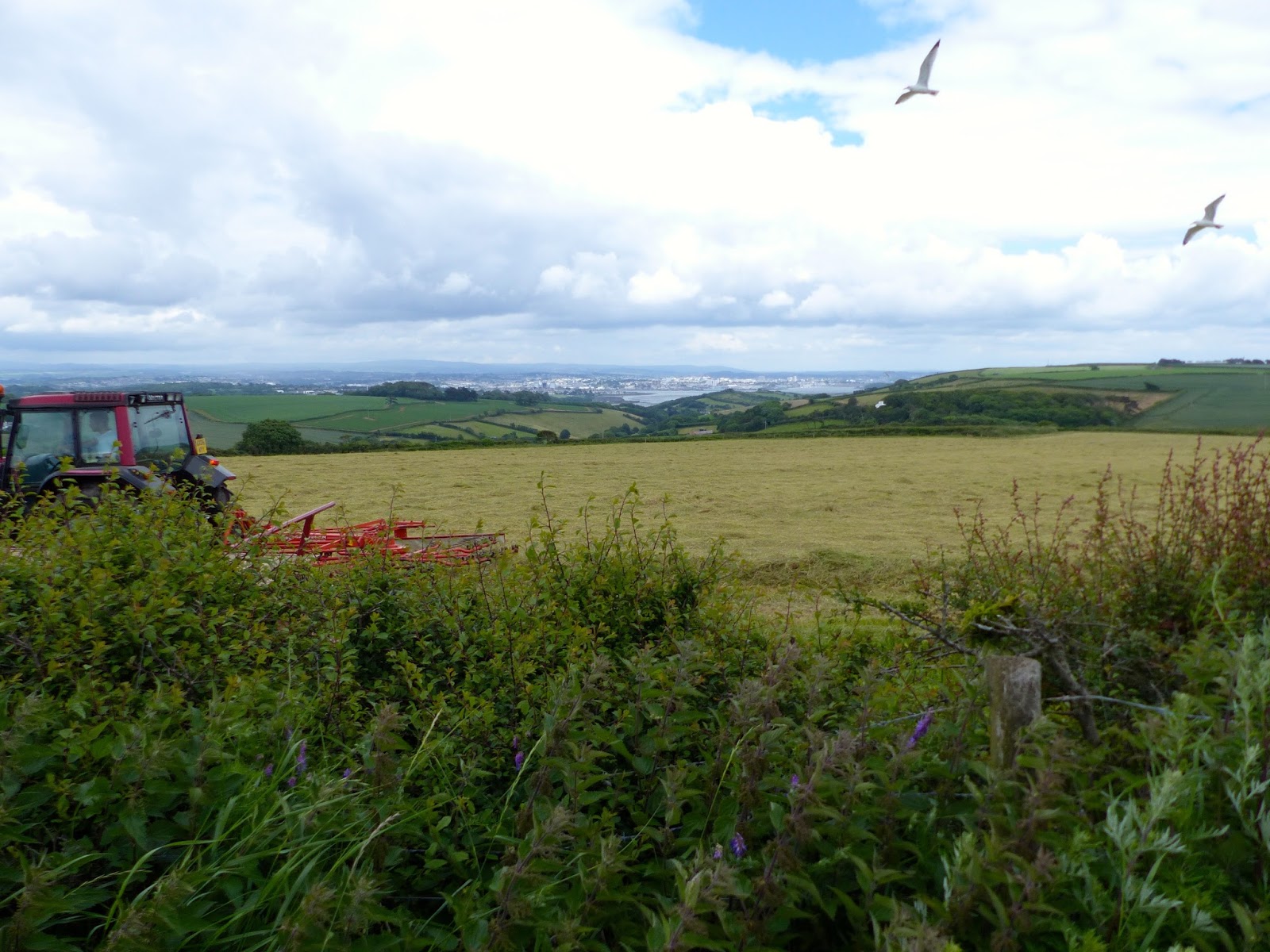
| Devon Lanes |
The next part of our journey we knew would take us up and down
country lanes and up and down little peninsulas where no coastal road followed
or joined them up.
Our first destination was Wembury and although there is a small
town of this name the area around is also called Wembury. We once had relatives
living here and so were able to find our way along the lanes to the village and
the beach. One thing I particularly
remember about Wembury, when I attended a family wedding here, is the bird
song. It is loud and beautiful. This is quite unlike Vancouver, where bird
song is actually a rarity. This is
mainly because the city has pine trees rather than deciduous ones that song
birds need to provide cover. Also it is
possibly due to the over abundance of crows and other raptors. We have an arborist attached to the council
near our home that believes that every tree is precious, even if it is dead and
even if it is immediately adjacent to a forest.
Her comments to me on one occasion, when I asked could a dead tree be
removed was “Well birds might want to sit in it”! Such trees do provide a roost
for birds, mainly crows, and on one near to my house I once counted 34 of
them. No wonder we don’t have bird song.
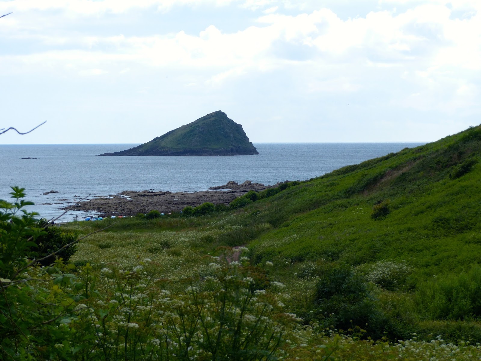 |
| The Mewstone |
From Wembury we were able to look out to sea and view close in,
the Mewstone a particular feature of the area and often used by the navy for invasion
practice. We could also just about make
out the Eddystone Lighthouse, 9 nautical miles south of Rame head.
 |
| The "New" Eddystone Light |
We had to drive up out of Wembury and then come down the other
side of the estuary to reach Newton Ferrers a very pretty (and expensive)
little town. Opposite this and reachable
on foot at low tide is the village of Noss Mayo. To get to it by car is about a 4 mile narrow
lane drive. There is an excellent pub
here serving great food and if the time is right you park on the beach. Provided you keep an eye on the tide table
and don’t drink too much this is a safe way to park your car and eat at the
pub.
 |
| Newton Ferrers |
 |
| Noss Mayo |
From here we drove through Mothercombe and about 13 miles in
total back up to the main road so that we could cross the River Erme and come
down its other side to Bigbury-on-Sea.
Apparently a lot of South West Coastal Path walkers get caught out here
as they assume that there is a ferry across the Erme. There isn’t one. It is either, arrive at low tide and wade
across or, walk 13 miles to get around it!
Bigbury-on-Sea has nothing going for it other than it is the
landward side of Burgh Island. Burgh
Island is a true island when the tide comes in.
It is separated from the mainland by a sandy causeway, which is easy to
walk across at low tide. However, when
the tide comes in, which it does from both sides of the sandy beach, there is a
tall tractor like machine that takes people to and from the island. On the island is the famous art deco style
Burgh Island Hotel. This has featured in
many an Agatha Christie “Poirot” movie and was the setting for her story “And
then there were none”. It was built as a
house by an industrialist in 1930 and only later became a hotel. The Beatles
have stayed here and so have Edward and Mrs. Simpson and Noel Coward.
 |
| Burgh Island |
The final part of our journey required us to retrace our steps
back up this time the estuary of the River Avon (not the famous one) and then
back down again to reach Thurlestone, where our B&B for the night was
located. This proved to be a bit of let
down for us as we were imagining much more luxury than it was. It promised sea views, but did not
deliver. It was also the only B&B on
my trip that did not have an en-suite bathroom.
It was also the most expensive B&B as well (by almost £20). We had actually had difficulty in getting a
booking for this night as being a weekend everyone wanted to let only to people
for 2 nights. I had not actually
experienced this anywhere else on my UK trip.
We ate at the Pub in the village, which is owned by and attached
to the hotel. This was OK but not particularly
special. I had expected a menu with more
variety. They let themselves down at the
end when having ordered strawberries and ice cream for dessert, after 20
minutes they had still not arrived, so we cancelled them, paid and left.
I spent most of the night sleeping on the floor as my back
problem, caused when I lifted my suitcase into the car in Grange-Over-Sands,
more than 10 days ago, was still with me and the bed was too soft.
 |
| Typical Cornish Lane (mettled cart track!) |
Altogether a very busy driving day, made enjoyable by the
presence of Marilyn. Also a day of stark
contrast in geography between Cornwall and Devon.
No comments:
Post a Comment